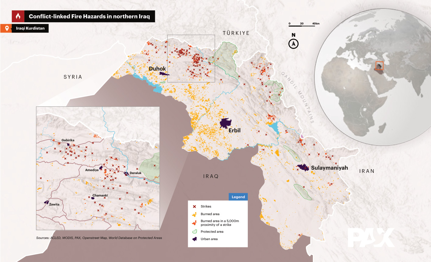
I carried out analyzes of 275 Sentinel-2 satellite images from the summer of 2024 for the NGO PAX. The aim was to detect burnt areas in the Kurdistan region in northern Iraq. For this purpose, the Sentinel-2 Burned Area Index (BAIS2) was calculated for each image, in which several color bands of the satellite data are related to one another. The images were then combined to create a overall result and divided into 5 classes representing different levels of certainty. With this data as a basis, the areas of burned areas could be calculated. Furthermore, the burned areas within a radius of 5 km from missile impacts were determined.
Article about the publication:
https://paxforpeace.nl/publications/wildfire-analyses-in-iraqi-kurdistan/
The introduction to the final publication and the full PDF can be found below:
The Kurdistan Region of Iraq (KRI) has faced a concerning rise in
wildfires in recent years. These fires pose both acute and long-
term threats to communities, livelihoods,and the region’s unique
biodiversity. The fires are primarily caused by a combination of
natural and human-made factors, including hot and dry weather
conditions, accidents, and increasingly military activities: fighting
between the Turkish Armed Forces and the Kurdistan Workers
Party (PKK) insurgent group. Beyond direct environmental
degradation, this fighting has also led to the displacement of
communities and the destruction of infrastructure. There are
also indications that these developments are compounded by
larger concerns over climate change in the KRI that are impacting
weather patterns and environmental conditions. The rapid increase
in temperatures, winds and dry vegetation all make the region more
prone to wildfires, which in turn affects livelihoods and engenders
displacement.

